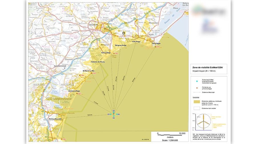
Carte présentant les zones d’impact visuel moyen d’un projet éolien offshore et les distances du projet par rapport aux communes côtières.
Charlène Fichot – Portfolio
Communication visuelle et Paysage
Carte présentant les zones d’impact visuel moyen d’un projet éolien offshore et les distances du projet par rapport aux communes côtières.